

On the Record
June 2, 2023
To: Project Manager, Binod Basnet, PE; [email protected]; (954) 777-4146
Subject: Repaving Corridor Widening Proposed for Bicycles A1A Sebastian Inlet to SR 510; Infrastructure Design Proposals on our NATIONAL SCENIC BYWAY!
Concerns: Saving the pristine scenic environment may be a better option than more bicycle infrastructure! Due to the tight scenic coastal strand and environmental issues this proposal may waste a lot of time and energy in unwanted opposition.
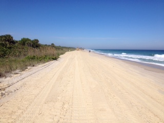
Property Owners and Environmental Concerns on this tight coastal strand: We are getting a bunch of calls about survey work and proposed pavement widening for larger bicycle lanes by approximately 2 feet on both sides of A1A! Many owners are concerned about our tight coastal strand and National Scenic Highway Corridor. Impacts to The Indian River Lagoon. The proposed expansion seems slight, but there are important environmental and site impacts. The project does not appear to fit our tight coastal strand. Many houses are ocean to river! Our community asked FDOT for swales between the Indian River Lagoon and A1A rather than a slope draining directly into the river. As a result, FDOT graded the slopes into swales which hold and percolate runoff. We have pictures of the swales holding runoff after rain events! The driveways in most of the subject area are tight due to FEMA Coastal Control Line setbacks. There are existing bike lanes on both sides of A1A. Bike use is rather limited in the area and most bikers use the sidewalk on the west side of A1A fronting the Indian river, because of the view! A bicycle expansion on the east and west side of A1A could be problematic for the environment and property owners. Public Access and Fishing: Expansion could impact parking and prevent historic public access to the Indian River Lagoon and beaches. Furthermore, there appear to be consequential property, drainage, and environmental impacts. Will this require property takings in the tight narrow corridor? Unintended Consequences Problem: Please protect our narrow natural coastal strand! Our residential community groups need much time to review any plans!
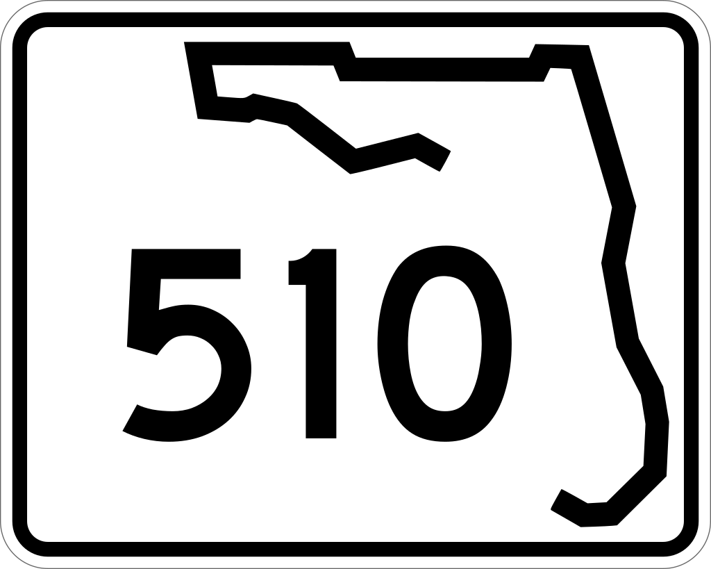
Setting a Local President: The Town of Indian River Shores and their population soundly rejected over improving the associated infrastructure in their A1A corridor. Indian River Shores, Johns Island, Orchid, and Windsor) North Beach Civic association attended the Indian River Shores FDOT meeting to protect the scenic coastal strand neighborhoods from over development of associated bike and pedestrian infrastructure. At that time, our North Beach Civic Association expressed concerns about the Indian River Shores neighborhood, and we asked DOT not to propose infrastructure development in our pristine narrow coastal strand area to the north. Bicycle Proposal 510 bridge: The high chain link bridge bicycle railing on 510 was an upset to the champions of our natural environment and the project was stopped with a railing redesign! Please no more green street markings and bright signage clutter in our scenic strand!
A National Scenic Highway, Historic Environmental Impacts, and the Potential Corridor Expansion Fit are issues; Natural Beauty: We ask you not to over improve our tight pristine NATIONAL SCENIC HIGHWAY strand corridor and allow the natural beauty to remain. Drainage Impacts: Removal of the swale area will cause increased drainage sheet flow into the Indian River! Historic Ponds: We have historic ponds along much of A1A which may be impacted by lane expansion. These freshwater ponds saved the survivors of the 1715 Spanish Treasure Coast Fleet. We are named the Treasure Coast! The ponds serve as habitat and support a flyway for many species of birds. Please carefully site check this issue with the Pelican Island Audubon Society, and others.
Roadway infrastructure expansion improvements could ruin the natural beauty and ambiance everyone is trying to protect including north island bikers. This is the home of Pelican Island Wildlife Sanctuary, Sebastian Island State Park, Jungle Trail, and other natural pristine areas. It is not a place for infrastructure expansion. Again, It appears there will be many stressful impacts, environmental concerns, and a possible taking of lands. It might be wise to provide more information directly to property owners or their representatives before decisions are made. There are many concerns!
Again, most of the area is a very tight coastal strand pristine scenic environment.
Residents do appreciate FDOT and your work in our community. We ask you to study our special corridor issues before you move forward on the bicycle proposal.
To: Project Manager, Binod Basnet, PE; [email protected]; (954) 777-4146
Subject: Repaving Corridor Widening Proposed for Bicycles A1A Sebastian Inlet to SR 510; Infrastructure Design Proposals on our NATIONAL SCENIC BYWAY!
Concerns: Saving the pristine scenic environment may be a better option than more bicycle infrastructure! Due to the tight scenic coastal strand and environmental issues this proposal may waste a lot of time and energy in unwanted opposition.
Property Owners and Environmental Concerns on this tight coastal strand: We are getting a bunch of calls about survey work and proposed pavement widening for larger bicycle lanes by approximately 2 feet on both sides of A1A! Many owners are concerned about our tight coastal strand and National Scenic Highway Corridor. Impacts to The Indian River Lagoon. The proposed expansion seems slight, but there are important environmental and site impacts. The project does not appear to fit our tight coastal strand. Many houses are ocean to river! Our community asked FDOT for swales between the Indian River Lagoon and A1A rather than a slope draining directly into the river. As a result, FDOT graded the slopes into swales which hold and percolate runoff. We have pictures of the swales holding runoff after rain events! The driveways in most of the subject area are tight due to FEMA Coastal Control Line setbacks. There are existing bike lanes on both sides of A1A. Bike use is rather limited in the area and most bikers use the sidewalk on the west side of A1A fronting the Indian river, because of the view! A bicycle expansion on the east and west side of A1A could be problematic for the environment and property owners. Public Access and Fishing: Expansion could impact parking and prevent historic public access to the Indian River Lagoon and beaches. Furthermore, there appear to be consequential property, drainage, and environmental impacts. Will this require property takings in the tight narrow corridor? Unintended Consequences Problem: Please protect our narrow natural coastal strand! Our residential community groups need much time to review any plans!
Setting a Local President: The Town of Indian River Shores and their population soundly rejected over improving the associated infrastructure in their A1A corridor. Indian River Shores, Johns Island, Orchid, and Windsor) North Beach Civic association attended the Indian River Shores FDOT meeting to protect the scenic coastal strand neighborhoods from over development of associated bike and pedestrian infrastructure. At that time, our North Beach Civic Association expressed concerns about the Indian River Shores neighborhood, and we asked DOT not to propose infrastructure development in our pristine narrow coastal strand area to the north. Bicycle Proposal 510 bridge: The high chain link bridge bicycle railing on 510 was an upset to the champions of our natural environment and the project was stopped with a railing redesign! Please no more green street markings and bright signage clutter in our scenic strand!
A National Scenic Highway, Historic Environmental Impacts, and the Potential Corridor Expansion Fit are issues; Natural Beauty: We ask you not to over improve our tight pristine NATIONAL SCENIC HIGHWAY strand corridor and allow the natural beauty to remain. Drainage Impacts: Removal of the swale area will cause increased drainage sheet flow into the Indian River! Historic Ponds: We have historic ponds along much of A1A which may be impacted by lane expansion. These freshwater ponds saved the survivors of the 1715 Spanish Treasure Coast Fleet. We are named the Treasure Coast! The ponds serve as habitat and support a flyway for many species of birds. Please carefully site check this issue with the Pelican Island Audubon Society, and others.
Roadway infrastructure expansion improvements could ruin the natural beauty and ambiance everyone is trying to protect including north island bikers. This is the home of Pelican Island Wildlife Sanctuary, Sebastian Island State Park, Jungle Trail, and other natural pristine areas. It is not a place for infrastructure expansion. Again, It appears there will be many stressful impacts, environmental concerns, and a possible taking of lands. It might be wise to provide more information directly to property owners or their representatives before decisions are made. There are many concerns!
Again, most of the area is a very tight coastal strand pristine scenic environment.
Residents do appreciate FDOT and your work in our community. We ask you to study our special corridor issues before you move forward on the bicycle proposal.

To: Project Manager, Binod Basnet, PE; [email protected]; (954) 777-4146
Scheduled Review Meeting: Sebastian City Community Center, 1805 Central Avenue, Sebastian, FL; 5:30 to 7:30; Thursday, December 15, 2022
Subject: Comments FDOT Sebastian Inlet Bridge to 510; our narrow coastal strand
Again, we want to go on the record regarding the Sebastian Bridge to 510 corridor Indian River County. The North Beach Civic Association represents most of the residents on the north ½ of the barrier Island. Our resident’s group are concerned about the scope and potential expansion impacts regarding the proposed infrastructure development changes to the Sebastian inlet corridor beyond the bridge area. Fixing or replacing the aged bridge is one issue most of us support, however, our community has reservations about changes the proposed infrastructure impacts could drive in the balance of the A1A to 510 corridor. The concern is impacts to our properties and the sensitive environment. We are in the Archie Carr Turtle Preserve and we do not want to change the rural pristine character of our neighborhood for huge expansions of bike and pedestrian infrastructure. AIA was designated as a scenic highway in the area between the Sebastian Inlet Bridge and SR 510. Our area is scenic, natural, and environmentally protected in nature.
Many of us are bikers, but we are concerned about over infrastructure development. Scenic can become lost by roads, bike lanes, and double 12 foot separated pedestrian lanes on each side of the highway. The Town of Indian River Shores just south of 510 prevailed against bikers’ expansion proposals similar to the wide bridge design. All of us are for safety, but we do not want to ruin our environment with too much infrastructure. Many of us feel bike use has been greatly exaggerated. The numbers seem to reflect a special onetime bike event. We saw a much smaller event on December 10, 2022. Normal bike use in subject corridor is very low. Bikers pushed a chain link fence project on the 510 bridge which the residents stopped before the contractor ran into financial trouble. The design had a potentially devastating effect on one the best river views in the state.
The simple two-lane roadway and sidewalk system we have on one side fits the community and our tight fragile barrier island. Expanding the bike lanes on both sides plus a barrier-separated 12-foot bike-pedestrian area on both sides of the roadway with grassed and wall separations will be hard to fit on the narrow coastal strand.
infrastructure Impacts on properties and possible taking of lands in the tight scenic coastal strand? Environmental Impacts: A huge concern is runoff and discharge into the Indian River Lagoon? Historic Impacts: Existing A1A ponds saved survivors of the 1715 Treasure Coast Fleet! Note the 1715 Museum. Where will the drainage and swales lie? Do we want an urban design with 24 feet of sidewalks the width of present A1A? There seems to be an urban size fit problem? Should the sidewalk be limited In size and kept in the existing location?

June 14, 2023
10:00 AM
Where:
Conference Room B1-501,
County Admin Bldg B,
1800 27th Street,
Vero Beach, FL 32960
Topic:
Metropolitan Planning Organization (MPO);
Share Your Concerns Regarding Proposed
SR A1A Widening & Bicycle Lane Expansion
10:00 AM
Where:
Conference Room B1-501,
County Admin Bldg B,
1800 27th Street,
Vero Beach, FL 32960
Topic:
Metropolitan Planning Organization (MPO);
Share Your Concerns Regarding Proposed
SR A1A Widening & Bicycle Lane Expansion
Meetings After Hurricanes Ian and Nicole:
Sebastian Inlet District
Regular Commission Meeting
Wednesday, December 14th, 2022, 4 PM
114 Sixth Avenue Indialantic, FL 32903
On AGENDA -- A) Authorized Work for Commission Review:
Work Order No. 2122-028-ATM, 2022/23 Upland Sand Truck Haul and Beach Placement Project
Also:
1. Applied Technology and Management, Inc. Change Order No. Work Order No. 2022-008-ATM, 2022 Post Construction Monitoring
2. Applied Technology and Management, Inc.
Work Order No. 2122-028-ATM, 2022/23 Upland Sand Truck Haul and Beach Placement Project
Also:
1. Applied Technology and Management, Inc. Change Order No. Work Order No. 2022-008-ATM, 2022 Post Construction Monitoring
2. Applied Technology and Management, Inc.
Focus on Sand Vote Approval- May ask for additional sand!
LINK TO MEETING AGENDA PAGE: https://www.sitd.us/commission-meetings
The Beach & Shore Preservation Advisory Committee
Regular Meeting
Monday, November 21, 2022
3PM
1801 27th Street
Vero Beach, FL. 32960-3365
County Administration Building B
Room B1-501
LINK TO MEETING AGENDA PAGE: https://www.ircgov.com/boards/BSPC/2022.htm
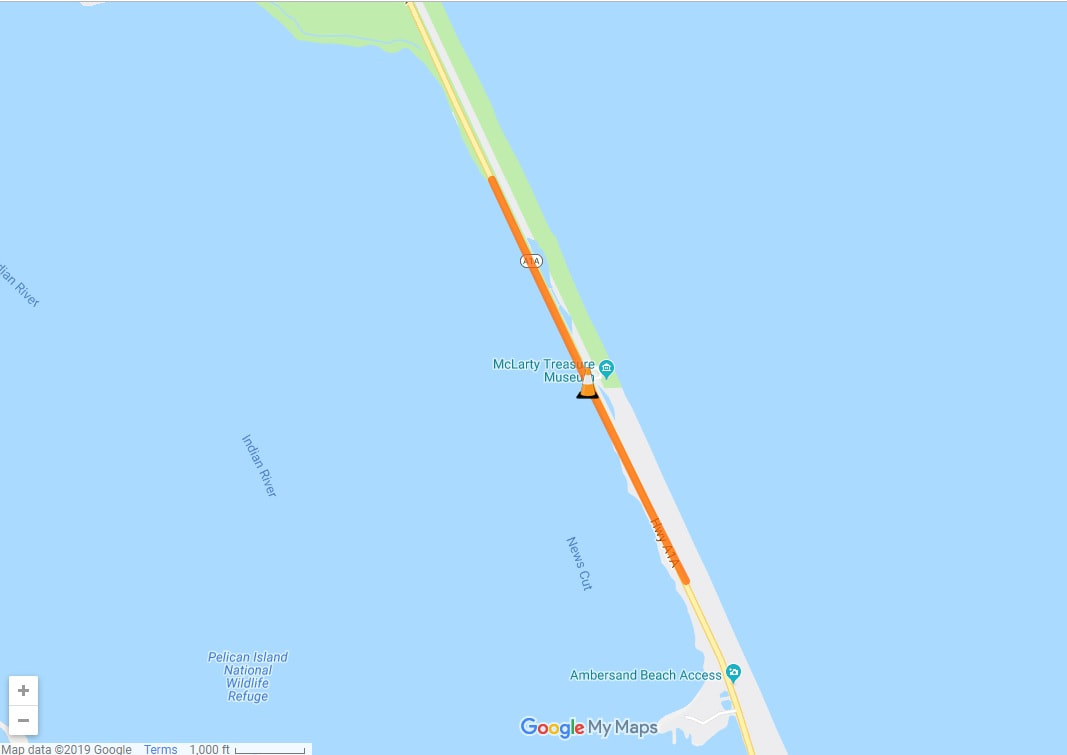
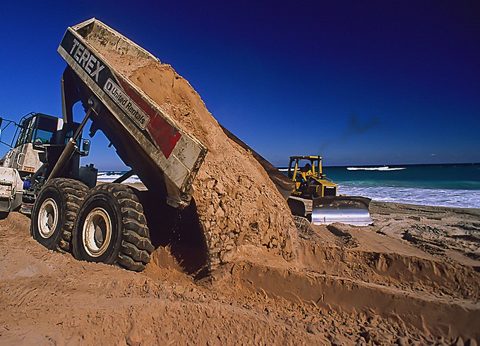
Ambersand Area:
There are 8 beach sectors. Many sectors had damage from back-to-back hurricane events
Ambersand south of Sebastian inlet is in the 1,2-sector area. The inlet district is mostly responsible for this area. There was a lawsuit regarding sand downdrift responsibility.
Ambersand south of Sebastian inlet is in the 1,2-sector area. The inlet district is mostly responsible for this area. There was a lawsuit regarding sand downdrift responsibility.
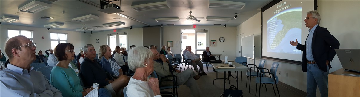
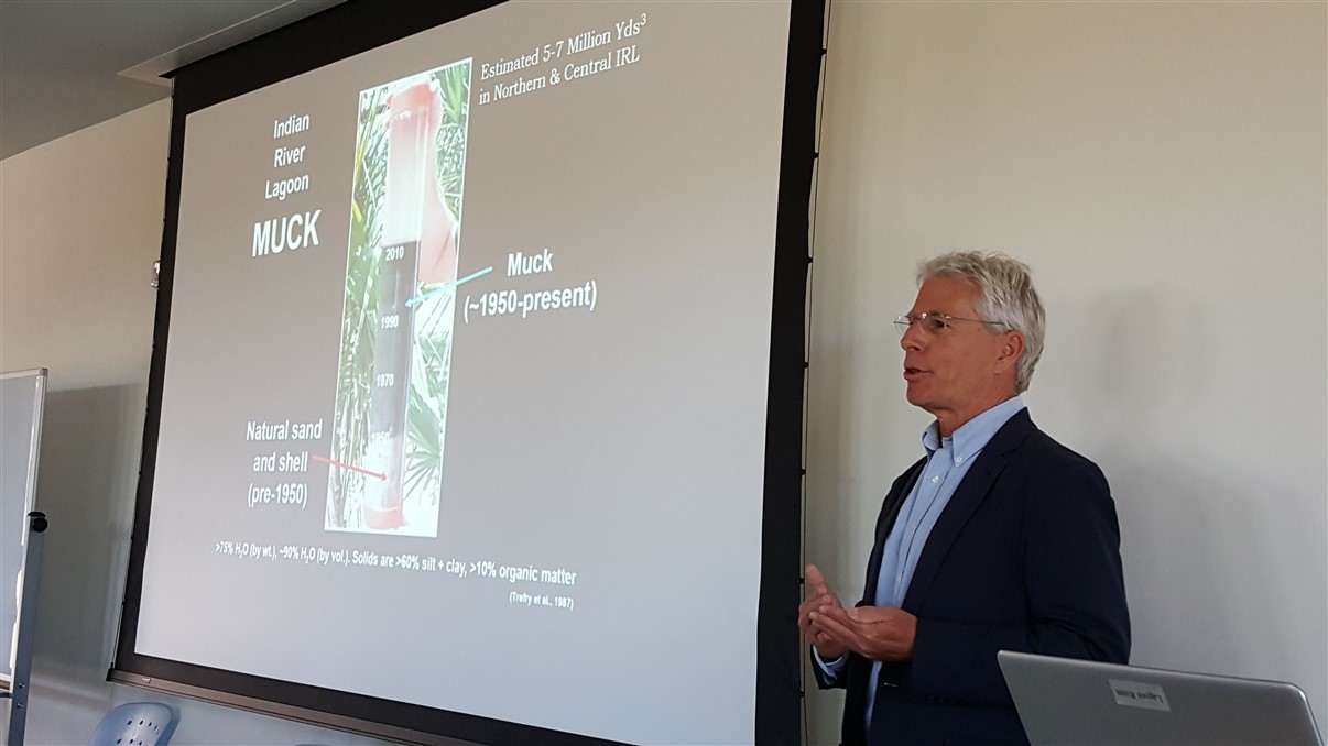
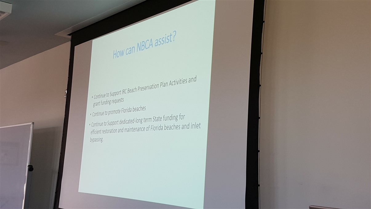

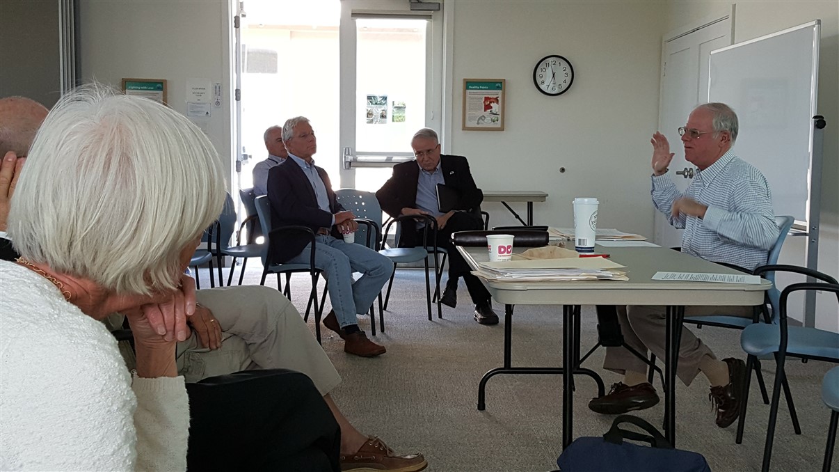
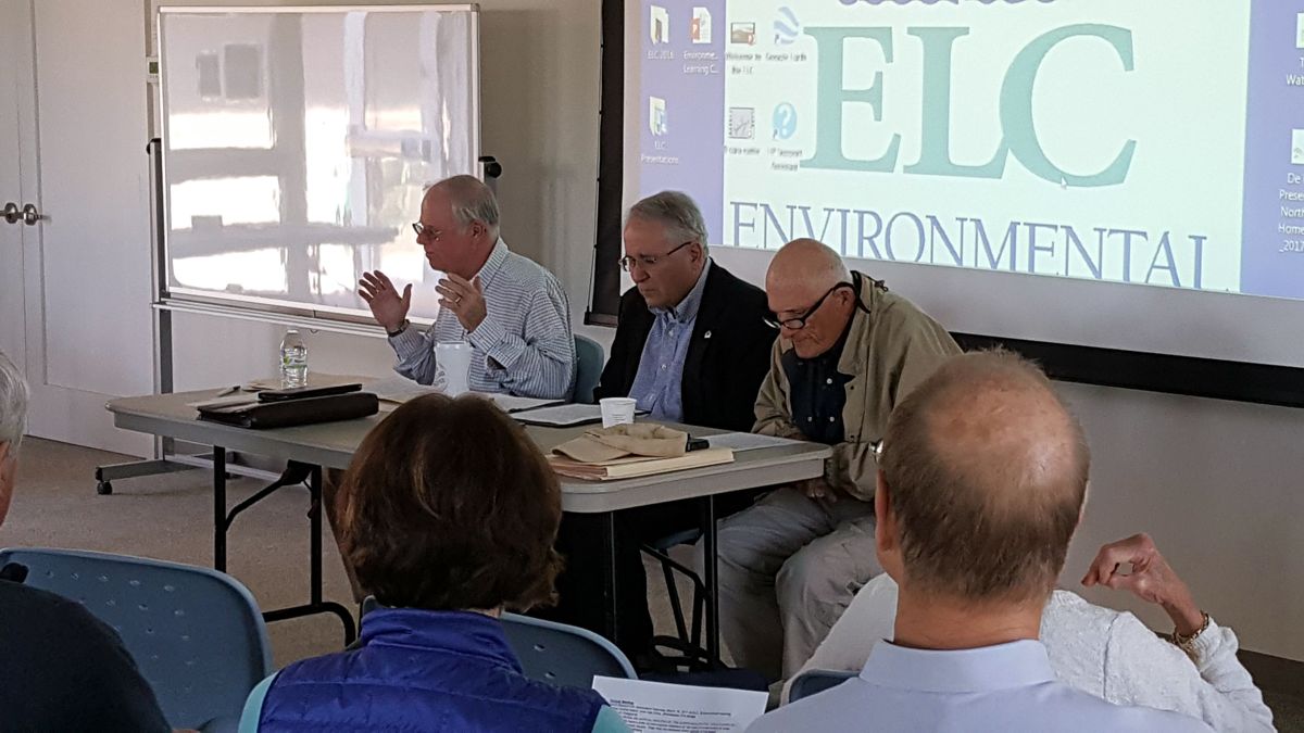
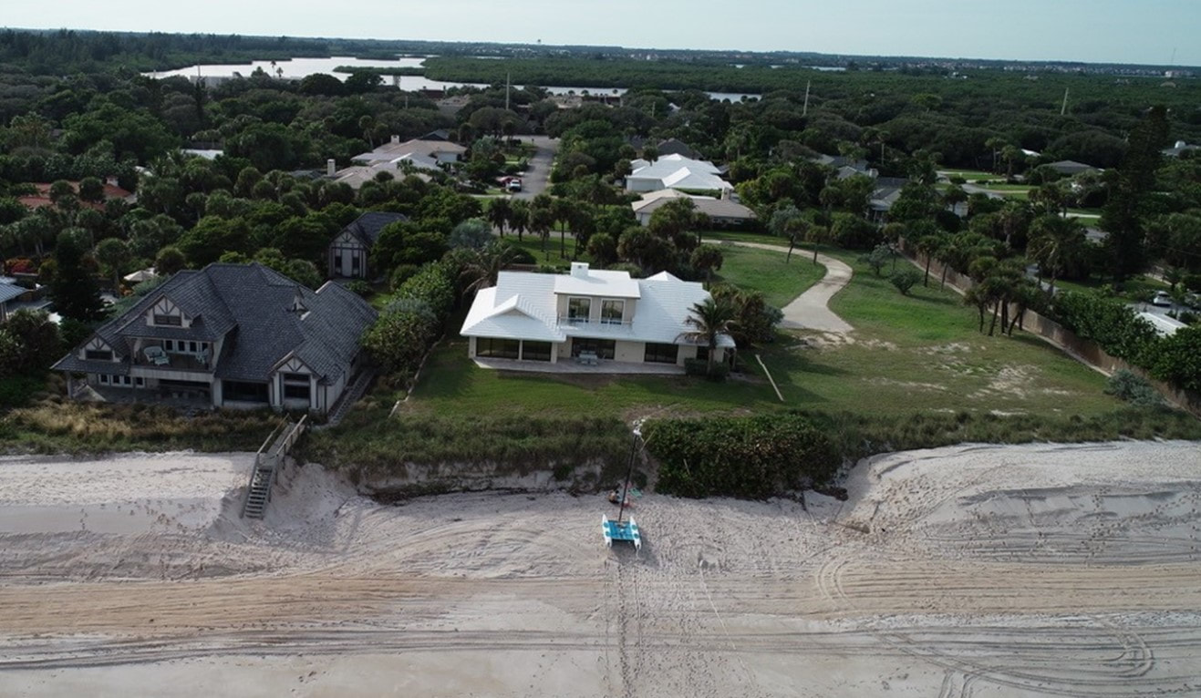
Image Credit: Ross Rowlinson
| sand_placement_easement_gap_image.jpg |
| easement_letter_nbca_7_.pdf |
State Road (SR) A1A Hurricane Matthew Restoration Project from Approximately 2.3 Miles South of the Sebastian Inlet Northerly 1 Mile on SR A1A
Financial Number: 440554-2-52-01 & 440554-2-52-02
Project Length: 1.035 miles
Project Limits: From Approximately 2.3 Miles South of the Sebastian Inlet Northerly 1 Mile on SR A1A
Start Date: June 8, 2019
Completion Date: Summer 2020
Contractor: Condotte America, Inc.
Estimated Construction Cost: $5,385,475
Scope of Work:
The improvements include: constructing a vinyl sheet pile wall system on the west side of SR A1A with reinforced concrete caps and placing rip rap with ditch lining to protect the shoreline against the storm surge and wave action from the Intracoastal Waterway during severe storm events; repairing the failed pavement areas within the southbound travel lane; installing a new southbound 8-foot concrete sidewalk; and installing thermoplastic striping and pavement markings.
Click here for upcoming lane closures
Click here to download more information about the project
| a1a_hurricane_matthew_restoration.pdf |
2018/19 SAND TRAP DREDGING AND BEACH PLACEMENT – ADVERTISEMENT FOR BIDS (8/10/2018)
The Sebastian Inlet District is seeking bids for the excavation of approximately 149,000 cubic yards of dredge spoil material from the sand trap and adjacent navigation channel at Sebastian Inlet. Approximately 30,000 cubic yards of this material is to be transported to the Dredged Material Management Area (DMMA) located roughly 2,300 feet from the sand trap within the State Park on the north side of the inlet and west of State Road A1A. The remaining volume of material will be placed on the beach approximately 2 to 3 miles south of the inlet.
The Bid Package is available in electronic form (CD) for a fee of $10 from the District Office: 114 Sixth Avenue, Indialantic, FL 32903. Call 321-724-5175. All questions about the meaning or intent of the Contract Documents shall be submitted to Sebastian Inlet District (OWNER) in writing by August 31, 2018 to be considered. Sealed bids will be received by the Sebastian Inlet District (OWNER) until 2:00 PM Monday September 10, 2018, at which time they will be opened publicly.
A Pre-Bid Conference meeting will be held on Friday, August 24th at 10:00 AM, at the DMMA facility; Sebastian Inlet State Park – 9700 South A1A, Melbourne Beach, FL 32951 – North Side.
ATTENDANCE AT THIS CONFERENCE BY ALL BIDDERS IS HIGHLY ENCOURAGED BUT IS NOT MANDATORY.
By: Martin Smithson
Administrator
SEBASTIAN INLET DISTRICT

When: March 18, 2017
Time: 9:00 AM
Where: Environmental Learning Center - Lagoon Room
Topics: Including the Beaches, lagoon, Brightline Train,
and water issues.
Time: 9:00 AM
Where: Environmental Learning Center - Lagoon Room
Topics: Including the Beaches, lagoon, Brightline Train,
and water issues.
Annual Meeting Recap
North Beach Civic Association (NBCA) on March 18, 2017 had their annual meeting to address issues affecting our quality of life in Indian River County (IRC). For those that missed it the speakers presented a wealth of information that affects our beaches and rivers. Dr. Dwayne Defreese, IR Lagoon National Estuary Council outlined the issues affecting the river and their first 25 projects to restore it back to a clean water source. He also announced that IRC has now joined the Council which helps us all. Mr. James Grey, IRC Coastal Engineer, gave a history of what has been done to the beach to preserve it and outlined future State and FEMA funding to support the beach. On a positive note, Federal and State funding appears to be increasing and needed beach repairs due to the last hurricane may be funded. IRC Commissioner Joe Fresher gave his perspective on beach and river issues and current and proposed actions the Commissioners were considering for the County. Lastly, Susan Mahiel and Phyllis Fry presented their organizations efforts to stop the All Aboard Florida/Brightline Initiative or at least to minimize its impact on our communities. In summary, all that attended walked away knowing many are working to preserve our way of life. NBCA is committed to do such. Please visit our web site northbeachcivicassociation.org to learn what we are doing to addressing County issues. Our mission is maintaining and improving our quality of life in Indian River County.
Your support and assistance is always appreciated.
By Chris Hendricks, Board Secretary
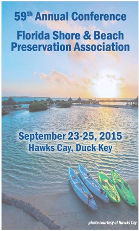
NBCA’s President, Tuck Ferrell and Vice-President, Peter Fallon, attended the annual (FSBPA) Florida Shores and Beaches Preservation Association’s annual meeting at Hawk’s Cay near Marathon in the Florida Keys from September 23-25.
The annual event concentrated on daily lectures and meetings concerning beach preservation, re-nourishment, and the state funding available for beach projects. A well-known coastal engineer, Mike Walther, from Vero Beach cited the enormous benefits of our beaches to the income they produce from hotels, restaurants, diving, and fishing businesses. Vero Beach is an end point destination for tourists who pump money into our tax base because our beaches attract them. He further pointed out that good beaches go hand in hand with protection of the upland tax base and preserving turtle habitat.
Also discussed, by the Army Core of Engineers, was the “sand battle” involving Miami’s need to replenish their beaches. Having run out of sand from their normal off-shore sources, the Corps now wants to explore the taking of sand from Martin and St. Lucie counties. As would be expected, officials from these two counties are adamantly against this and voiced their opinions to the Corp’s head, Colonel Kirk. His position was that the Corps can take any sand they want within the twelve-mile limit along the eastern seaboard. The cost to barge any sand to Miami from these two counties would be exorbitantly cost prohibitive (240 miles per round trip) and could critically reduce the sand borrow sites available for any future replenishment projects for both counties. Barging in sand from the Bahamas would produce good sand (60 miles one way) but doing so is fraught with legalities between the US and the Bahamian government.
At present, Indian River County is not a candidate for Miami’s sand but our county officials need to be aware of the Corp’s potential to use our sand sources. The county’s coastal engineer, James Gray, and County Commissioner, Tim Zorc, who also attended, heard the Corp’s intentions and will fight any attempt by the Corps to “steal” our local sand.
We all need to remain vigilant about the Corp’s intentions. NBCA, the IRC County Commission, and the Sebastian Inlet Executive Director, Marty Smithson are well aware of the devastating effects of losing our sand to Miami!
On a final note, the state’s budget for sand management this year is 25 million, about half of what it was last year. Every county will be fighting for its piece of the pie. Rest assured that NBCA and our County Commission will be doing their best for our members to get our fair share.

County passes law prohibiting commercial events at rented residences
5:21 PM, Sep 22, 2015
INDIAN RIVER COUNTY — Renting a house for a wedding or family reunion became outlawed Tuesday by the Indian River County Commission.
Commissioners voted unanimously for a new law prohibiting, effective Sept. 30, commercial events at a residential house rented for that event. This includes weddings, birthdays, reunions, meetings or parties.
Those who already have precontracted events within one year are unaffected by the new law, but must show proof of those events by Oct. 31. Homeowners who host the events or provide the home for free for such events also are unaffected by the law.
Wedding professionals complained the law would cause the county to lose thousands in tourism revenue from visitors coming to the county for a beach wedding or other large event. Other residents applauded the commissioners for doing something to control events they say have disrupted their neighborhood.
Link to full article: http://www.tcpalm.com/news/local-news/indian-river-county/news-briefs/county-passes-law-prohibiting-commercial-events-at-rented-residences_91668453
| county_passes_law_prohibiting_commercial_events_at_rented_residences_-_tc_palm.pdf |

Hiassen: Train-load of questions about a train
Carl Hiaasen, Syndicated columnist 12:02 a.m. EDT August 15, 2015
If you've got some extra cash lying around, here's an idea:
Sink all your hard-earned dollars into tax-free bonds for All Aboard Florida, the high-speed passenger train service that will supposedly run between downtown Miami and the Orlando airport.
Or, for the same return on your investment, take all your cash, dump it in a bucket and light it on fire.
Every passenger rail service in the United States loses money, but All Aboard Florida last week was approved to sell $1.75 billion in municipal bonds to finance its 235-mile fantasy. The private firm promises to put up about $700 million in equity and assume all debt.
The bonds will be unrated because of the absurdly high risks, which required a couple dozen pages to explain.
Bottom line: It will be impossible for the train project to ever make a profit. If your broker calls up and tries to sell you some of these bonds, fire the fool.
Here's the pitch you might hear: When the project is finished, All Aboard Florida will be running trains between Miami and Orlando 32 times a day at speeds exceeding 100 mph.
The company won't say what the price of a ticket will be, yet it predicts yearly revenues of $300 million. No less rosy is its ridership projection of 5.4 million passengers annually by 2020 — about 14,000 riders daily.
Whoever cooked up these numbers must have been heavy into the mushrooms. It sounds like they basically sat around listening to Pink Floyd and making stuff up. Clearly they paid no attention to historical rail-use data.
Mass transit is terrific when it's truly used by the masses, but even then it can't function without huge taxpayer subsidies. Amtrak already runs roundabout routs between Miami and Orlando, but the trip has frequent stops, takes several hours and, of course, loses millions.
All Aboard Florida's trains will also be traveling a non-linear track. After leaving Miami they'll stop in Fort Lauderdale and West Palm Beach. Then they head up the seaboard all the way to Cocoa — don't ask why — where they turn due west on a yet-to-be-built 40-mile stretch to Orlando.
Executives for All Aboard Florida say the price of the trip will be comparable to what you'd spend going by car — as if a sane person would willingly drive directly from Miami to the Orlando airport.
Most motorists go straight to Disney World or Universal. If you ride the new train, however, you'll have to catch a tram, cab or rental car from the airport, adding time and costs to your trip.
Still, lots of people in South Florida are excited about All Aboard Florida. This is because of the prospect of a quick connection between Miami, where work already has begun on a new station, and West Palm.
That leg would definitely appeal to highway commuters, though it would still bleed money. Farther north, where the trains won't stop, All Aboard Florida isn't very popular.
Indian River and Martin counties have sued to halt the project, for good reason. Towns along the Florida East Coast railroad tracks will see traffic stymied at local crossings 32 times every day while the trains zip back and forth.
Residents, business leaders and officials fear the horns, noise and congestion will drive down property values. First-responders have also warned that the frequent lowering of crossing gates will impede ambulances and police cars responding to emergencies.
Still, the federal government and state of Florida have allowed the train project to roll forward. The only thing that can derail it is lack of funds. Just wait.
But for now, nutty as it seems, somebody somewhere will get suckered into buying All Aboard Florida's bonds.
The deal is so dicey that a consultant for the state's financing authority recommends that the bonds be sold in $100,000 blocks only to "accredited investors" or "institutional buyers."
They might know how to bail out before they get hurt.
Among the "significant" risks of All Aboard Florida listed in a lengthy memo prepared by Bank of America Merrill Lynch:
"The company is not providing all the information that would be required if the company were being registered with the Securities and Exchange Commission."
Picky, picky, picky. What else?
"The company currently has no revenues or cash flows and has never constructed or managed a passenger railroad."
Well, OK, that's not so great.
But there's a first time for everything, right? We're only talking about $1.75 billion, and it's not like you're taking it to Vegas.
Where your odds would actually be better.
Link to full column online at Florida Today Newspaper here: http://goo.gl/BCgJw1
|

|
| hiassen__train-load_of_questions_about_a_train.pdf |
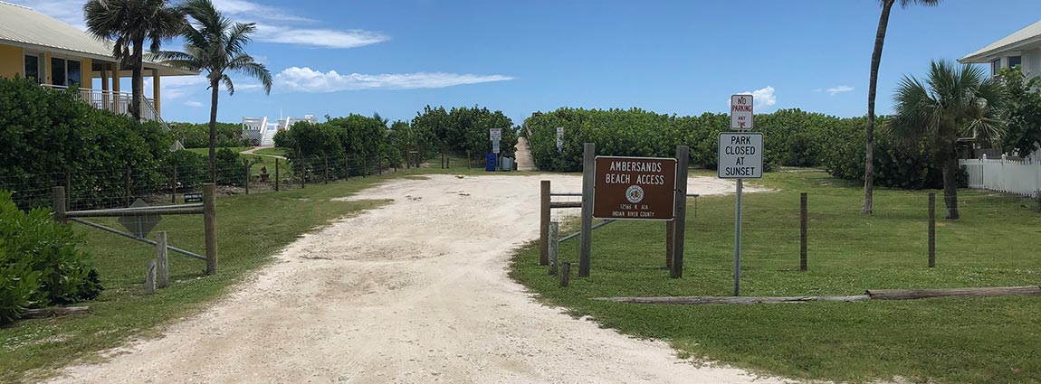
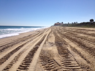
Starting this week, the Sebastian Inlet Commission will be placing sand on the beach to build up the dune line that was lost during the recent North East storms that caused a deep cut resulting in a drop-off of 6-8’ in some places. It will be placed from roughly a quarter mile south of the Ambersands Beach parking lot up to the McClarty Museum and tapered into the south end of the park.
Note: there will be heavy duty trucks going up and down the beach delivering sand from the storage area north of the inlet. Please advise all family members and visiting guests to not get in the way of these trucks and be careful of them when on the beach.
This sand was dredged from the “sand trap’ a man-made depression west of the inlet bridge that collects the sand from the incoming tides and was stored north of the wading pool. The “sand trap” allows the Commission to dredge during the turtle season in order to store it for distribution in emergencies.
We continue to have excellent cooperation with the Sebastian Inlet Commission and its outstanding Executive Director, Mr. Marty Smithson. Under his guidance the Commission is doing everything possible to maintain the North Beach area in addressing the yearly loss of sand caused by the inlet’s south jetty.
###
Please see the below construction update on the Sector 3 Dune Repair Project between November 10th and 14th, 2014 (week 1).
Sector 3 Dune Repair Project Construction Summary (Week 1)
· restoration project consists of placing approximately 140,000 cubic yards of sand to repair approximately 31,000 feet of dunes.
· 6 miles of coast between Treasures Shores Park and Town of Indian River Shores.
· Sand provided by upland (inland) sand mines and delivered via truck.
· Guettler Brothers Construction, LLC. (Guettler) of Fort Pierce selected by County to perform work.
· $3,076,920 project construction cost shared 50:50 between County and FDEP.
· Construction mobilization commenced on November 5, 2014 with sand hauling commencing on November 10, 2014 through the Treasure Shores Beach Park Access.
o Treasure Shores Beach Park is currently closed to the public.
· Project completion expected prior to April 30, 2015.
As of November 10, 2014, Guettler has placed approximately 12,000 of the estimated 140,000 cubic yards of sand needed to fill the project design template. Beach access has been through Treasure Shores Beach Park. Total linear feet of beach completed to date = 2,200 feet of 31,000 (approximately 7% of the total project completed). Guettler expects to complete the Treasure Shores access location on November 18, 2014 and move to the Golden Sands Beach Park location by Wednesday, November 19, 2014. Guettler is currently hauling, placing, and grading beach sand at an average rate of 2,400 cubic yards per day. As of today, all project sand has been supplied from the Davis Sand Mine. Guettler intends to have the Davis Mine supply about 60% of the required sand with the balance coming from the Hammond/Blue Goose Sand Mine. Beginning November 17, 2014 the Davis and Hammond mines will both begin delivering sand to beach. Currently the Davis Mine has an available beach sand stockpile of 40,000 cubic yards and the Hammond Mine has 15,000 cubic yards. It appears that Guettler will have an adequate supply of sand to maintain its current production rates.
Current Beach Park Closure Schedule
Treasure Shores Beach Park: Closed - November 5, 2014 – November 19, 2014
Golden Sands Beach Park: Closed – November 19, 2014 – December 31, 2014

BILL POSEY
MEMBER OF CONGRESS
8TH DISTRICT, FLORIDA
120 Cannon House Office Building
Washington, D.C. 20515
For Immediate Release
November 12, 2014
CONTACT: George Cecala (202) 225-3671
House Passes Posey-Murphy Bipartisan Plan to Help Estuaries with Critical Needs
WASHINGTON, DC – Today the U.S. House of Representatives passed legislation (H.R. 5266) to reauthorize funding for the National Estuary Program (NEP). Reps. Bill Posey and Patrick Murphy, two of four principle co-authors of H.R. 5266, were able to secure the inclusion of their bipartisan plan (H.R. 5117) to reprioritize existing funding so more money is available for estuaries with critical needs like our Indian River Lagoon. In July, Posey and Murphy introduced the Estuary Urgent Needs Priority Program Act to meet high priority needs across the nation’s 28 national estuaries.
“This common sense plan will help provide critical funding for our nation’s estuaries, and make available additional funding to estuaries that are experiencing urgent and challenging ecological problems, including our own Indian River Lagoon,” said Rep. Posey. “I’m pleased to see this important legislation move forward in a strongly bipartisan manner.”
“It is great to see the House act swiftly on the National Estuary Program to help support the health of our waterways. The Treasure Coast will directly benefit because this bill includes our bipartisan proposal to prioritize the Indian River Lagoon,” said Rep. Murphy. “With the health of our economy directly tied to our waterways, this common-sense measure is well-deserving of the overwhelming bipartisan support it received today, and I hope that the Senate quickly follows suit.”
In addition to providing strong funding for base NEP grants, the Posey-Murphy plan directs the Environmental Protection Agency (EPA) to prioritize funding to provide additional awards for estuaries that are experiencing urgent and challenging ecological problems. Some problems include: sea grass loss, reoccurring harmful algal blooms and invasive exotic species or jellyfish proliferation. These awards would be provided on a competitive basis and would be funded through funds already authorized for the NEP program. The base bill also secures higher levels of funding for each estuary’s base grant.
Under H.R. 5266, the National Estuary Program is reauthorized for Fiscal Year 2015 at $27 million. The Posey-Murphy plan makes 15% of appropriated funds available for the additional competitive awards to estuaries with urgent needs. The bill also gives direction to the EPA to ensure that no less than 80% of the funding is reserved for estuary base grants.
The National Estuary Program, which enjoys broad bipartisan support, was created in the 1987 Clean Water Act Amendments. It is run through the U.S. Environmental Protection Agency to protect and restore water quality and ensure ecological health of estuaries of national significance. There are 28 “estuaries of national significance” that span multiple states and congressional districts all over the country. Each estuary uses local input and local priorities to create a management plan that addresses the issues of water quality and ecological health.
Click Here to watch Rep. Posey’s Floor Speech.
# # #
| nepplanpasseshouse-nov122014-release.pdf |
Beach Renourishment to Start in December for North County
Mr. Marty Smithson, Executive Director of the Sebastian Inlet District, recently announced that the sand stockpiled from this years dredging of the Sebastian Inlet channel will be placed on the beach south of the inlet starting in mid-December. The cost of the project is $525,000 with half being paid by the state. The 50,000 cubic yards of sand will be screened to separate out any small chunks of coquina rock before being put on the beach and will be placed between markers R-11 to R-17 (roughly from the Ambersands Beach parking lot north to the McClarty Museum) to build up the dune line lost during the summer storms. This is the pile of sand that can be seen on the north side of the inlet behind the wading pool and came from the dredging of the channel west of the bridge where the sand trap was deepened during the last dredging. The trap collects the sand from each incoming tide and, once filled up, the sand can be transferred to the holding area to be used to re-nourish the beach after the turtle season ends on November 1.
Mr. Marty Smithson, Executive Director of the Sebastian Inlet District, recently announced that the sand stockpiled from this years dredging of the Sebastian Inlet channel will be placed on the beach south of the inlet starting in mid-December. The cost of the project is $525,000 with half being paid by the state. The 50,000 cubic yards of sand will be screened to separate out any small chunks of coquina rock before being put on the beach and will be placed between markers R-11 to R-17 (roughly from the Ambersands Beach parking lot north to the McClarty Museum) to build up the dune line lost during the summer storms. This is the pile of sand that can be seen on the north side of the inlet behind the wading pool and came from the dredging of the channel west of the bridge where the sand trap was deepened during the last dredging. The trap collects the sand from each incoming tide and, once filled up, the sand can be transferred to the holding area to be used to re-nourish the beach after the turtle season ends on November 1.

Indian River County NEWS, July 2014 -- Wabasso Beach: Approved, a Beach and Dune Infrastructure Maintenance Matching Funds Request from the severe hurricane events of 2004-5! The state programmed restoration of over 4.7 million dollars in matching funds will help provide the infrastructure maintenance for our dunes and beach environment!
A successful team effort: A request by North Beach Civic Association and others! We greatly appreciate help and assistance of the Legislative Delegation during the 2014 Legislate Session. Special thanks to Senators Joe Negron (Chair Appropriations), Senator Altman, Representatives Debbie Mayfield, and Steve Crisafulli (speaker)!
In addition, we appreciate the help and support from all five of our Indian River County Commissioners, county staff, Florida Beaches and Shores Association, Governor Scott and others regarding beach matching funds. James Gray, our Coastal Engineer, deserves special credit for his persistent reminders and helping lead us through the process!
The beach systems are critical to state tourism, our quality of life, the tax base, and most important, record Green Turtle, Loggerhead, Leatherback, and Kemps Ridley nesting. Additionally, the Barrier Island nesting dunes protect homes, property, the Indian River Lagoon, and the Vero Beach Indian River County mainland.
Maintaining the beautiful Treasure Coast and Barrier Island! Additionally, we are not a Federal eligible inlet County thus we are more dependent on state assistance! Our beach/River park areas, especially Sebastian Inlet Park, Pelican Island, Wabasso Beach are and important tourism magnets and destinations in the state!
Posey Leads House Approval of Bipartisan Algal Bloom Research Bill to Benefit the Indian River Lagoon
WASHINGTON, DC – Today Congressman Bill Posey (R-Rockledge) helped usher through the House of Representatives important bipartisan legislation (S.1254) to reauthorize and enhance research into the causes of algae blooms and hypoxia events which are harmful to natural habitats like the Indian River Lagoon. Posey partnered with Rep. Suzanne Bonamici (D-OR) to amend the bill on June 5th in the House Science Committee to better enhance the coordination research across federal, state and local agencies to avoid duplication and ensure better accountability of resources.
“This bipartisan, bicameral legislation will reauthorize robust funding for important research leading us to a better understanding of the causes, effects and steps we can take to prevent and address harmful algal blooms and hypoxia events,” said Congressman Posey. “The overall health and water quality of our Indian River Lagoon and all of our nation’s waters will be improved with this important legislation.”
Specifically, the bill will reauthorize $20.5 million per year through 2018 for the National Oceanic and Atmospheric Administration (NOAA) to distribute as grants to local governments and organizations to conduct research into algae blooms and hypoxia events. Recent algal blooms have had an adverse impact on the Indian River Lagoon’s health which is evident in the loss of more than 47,000 acres of sea grass since the spring of 2011. The lagoon has also experienced a number of unexplained fish kills, along with manatee, dolphin and pelican deaths.
“This bill gives researchers another tool to help us better understand, anticipate, control, and mitigate harmful algal blooms like those we have seen in the Indian River Lagoon and in communities across the country,” said Posey.
Watch Rep. Posey's full remarks are here or read his floor statement is here.
###
| algaebloompasseshoue-june92014-release.pdf |
| posey_harmful_algal_bloom_floor_speech_june_9_2014.pdf |

INLET UPDATE:
Extra dredging of the sand trap produced a little over 50,000 cubic yards of excellent high quality sand that has now been stored on the north side of the inlet The sand is currently mixed in with rocks but will be thoroughly screened before being placed on the beach. The sand trap has also been lowered and contoured to a flat bottom whereas before it had been very irregular with stony projections that interfered with the dredge. Once the proper bids have gone out, Inlet Commission Executive Director Marty Smithson will see that the sand is placed on the beach soon after the turtle season ends on November 1. The sand will be for dune re-nourishment and will start a bit south of the Ambersands Beach parking area and be placed northwards. It should give greater protection to the turtle habitat and protection of the upland structure's tax base. Now that the sand trap has been re-configured, we should see a consistently larger return of the sand it captures that can be placed on the beach on a regular basis. While the sand accumulated in the trap will never be the total amount needed for the beach, it will always be available to supplement the regular dredging.
Extra dredging of the sand trap produced a little over 50,000 cubic yards of excellent high quality sand that has now been stored on the north side of the inlet The sand is currently mixed in with rocks but will be thoroughly screened before being placed on the beach. The sand trap has also been lowered and contoured to a flat bottom whereas before it had been very irregular with stony projections that interfered with the dredge. Once the proper bids have gone out, Inlet Commission Executive Director Marty Smithson will see that the sand is placed on the beach soon after the turtle season ends on November 1. The sand will be for dune re-nourishment and will start a bit south of the Ambersands Beach parking area and be placed northwards. It should give greater protection to the turtle habitat and protection of the upland structure's tax base. Now that the sand trap has been re-configured, we should see a consistently larger return of the sand it captures that can be placed on the beach on a regular basis. While the sand accumulated in the trap will never be the total amount needed for the beach, it will always be available to supplement the regular dredging.

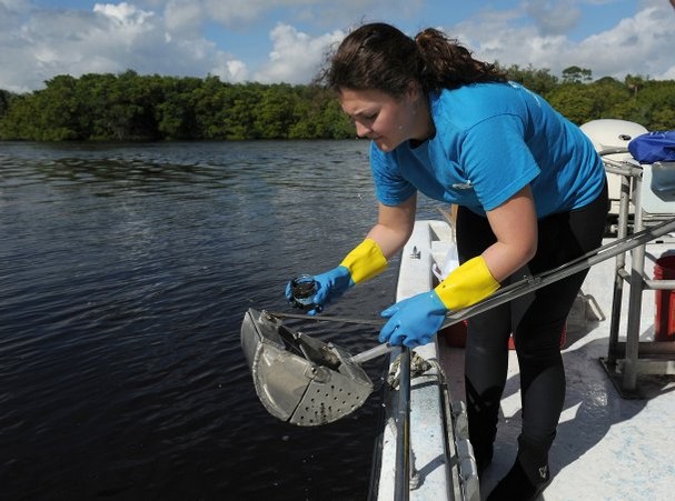
Special report: Unprecedented Indian River Lagoon study finds herbicides in water |
Experts say newspaper investigation is first to uncover traces of chemicals blended into household herbicides in local waterways
By Scott Wyland
Sunday, February 9, 2014
At a slow-moving stream near a highway bridge, two marine researchers donned protective gloves and dipped jars into green, algae-coated water littered with plastic cups, wrappers and other trash.
The water samples they took in late 2013 from the south relief canal, which flows under U.S. 1 in Vero Beach and into the Indian River Lagoon, tested positive for three different herbicides that could compound pollution in the blighted estuary.
Earlier that day, the researchers scooped sediment samples from the mouth of Taylor Creek canal in Fort Pierce, where a brown, soupy liquid floated on the surface as dirty freshwater spilled into the inlet. The muck there also tested positive for a chemical herbicide.
These findings are unprecedented because the lagoon has never been tested for herbicides, local researchers say.
Ocean Research and Conservation Association staffers collected several dozen samples in December at six sites in the lagoon and adjoining tributaries along a 55-mile stretch between Stuart and Vero Beach.
SunLabs in Tampa analyzed the samples and, in a few, found traces of glyphosate, diquat and Indaziflam — chemicals blended into household weed killers such as Roundup and Rodeo. Governments, farmers and landscapers also use the herbicides to remove unwanted vegetation in canals, citrus groves, golf courses, lawns and roadside ditches.
These chemicals are most likely to enter waterways as runoff flowing through drainage canals, researchers and industry experts say.
ORCA assisted Scripps Treasure Coast Newspapers and WPTV NewsChannel 5, which paid to have 18 samples tested as part of an investigation into whether herbicides might leach into the lagoon and possibly contribute to sea grass die off. Much higher concentrations can harm fish and mammals, though regulatory agencies don’t specify the thresholds when this could happen. Most experts point to nitrogen and phosphorous from fertilizers and sewage spurring algae blooms that overtake sea grass, giving little or no attention to stray chemicals that might harm this fragile flora.
Vanishing sea grass — a vital part of the lagoon’s food web — is linked to more than 110 manatees dying in the northern lagoon in the past year.
“I think it’s been on a lot of people’s minds — which chemicals are impacting the lagoon, ” ORCA Managing Director Warren Falls said. “What we did with this survey was pinpoint something that was interesting. It’s concerning that it’s there.”
There are no state or federal rules restricting how much of these herbicides can be in waterways. The U.S. Environmental Protection Agency’s rules only apply to the amount of herbicides allowed in drinking water.
Falls said he is unsure whether the minute traces that were found show herbicides are hurting the lagoon. Still, the presence of herbicides no longer can be dismissed as pure speculation, making the findings important, he said.
Can't see the interactive graphic? Click here.
Finding the sources of herbicide pollution is the first step to cleaning it up, Falls said.
Although the chemicals detected were minute, they should act as a springboard for ORCA to pursue funding for more extensive studies of the lagoon’s herbicide pollution, Falls said. If no herbicides had been found, ORCA would have little chance of obtaining grants for further study, partly because funds have gotten much tighter in recent years, he said.
Many more samples should be taken, and tests should target a longer list of herbicides and pesticides, Falls said. A detailed study should be done on where the herbicides come from and whether they deplete sea grasses, he said, adding most research looks at how the chemicals kill weeds on land.
“There’s a lot of finger pointing, but not much data on how herbicides affect the waterways,” Falls said.
TIP OF ICEBERG?
Florida, with its sultry weather, is a land of weeds.
Homeowners, grounds keepers, landscapers, growers and public agencies all spray herbicides to combat pesky vegetation, including aquatic plants.
Government agencies and private contractors douse weeds in swales, canals and retention ponds to keep water flowing freely and avoid flooding during storms. An unknown amount of the herbicides taint the stormwater running into rivers and the lagoon.
Counties, cities and mosquito control districts on the Treasure Coast use an array of herbicides, including the three detected in the lab tests, records show. Triclopyr, imazapyr and the Agent Orange derivative 2,4-D — all commonly used to kill aquatic vegetation — also show up on some agencies’ lists.
Aside from gleaning samples for the newspaper, researchers Retta Rohm and Chloe Lloyd took 30 samples for ORCA so it could run a broad toxicity test by observing how a bio-luminescent organism reacts to the water and silt. The organism’s response indicated some of the sediment was toxic, and further tests would be needed to identify the contaminants, Rohm said.
Herbicides would’ve been more likely to show up in the St. Lucie River during the Lake Okeechobee discharges, which were halted weeks before the samples were taken, Falls said.
Falls said he’s surprised researchers found herbicides at any of the sites, given the sampling was small for such a large area, and it was done during the dry season when stormwater runoff, which carries herbicides, has slowed to a trickle.
“It’s troubling that we did find it in the dry season,” Falls said.
However, SunLabs supervisor James Huebbers said he doubts the low amounts of herbicides detected would hurt aquatic vegetation. Weeds normally get doused with chemical compounds to kill them, he said.
“It would be unlikely these would be contributing to the loss of sea grass,” Huebbers said.
Huebbers also rebutted Falls’ assertion that lesser runoff in the dry season would mean a lower level of herbicides. These chemicals might be diluted more with a stronger stormwater flow, he said.
Patrick Brown, a Vero Beach physical chemist, said stormwater can dilute chemicals but it also carries more contaminated sediment.
After crews spray canals, a chemical residue coats the dead plants and become sediment, Brown said. “When it rains, the dead plants as sediment flow into the Indian River Lagoon.”
SPARSE RESEARCH
More testing is needed to determine the source of herbicides and whether they deplete sea grass or harm the ecosystem in other ways, Brown said.
For now, crews should stop spraying herbicides in and around canals and swales, Brown said. Instead, they should cut the weeds with power equipment, as was the norm years ago, he said.
Ray Hooker, a Vero Beach landscaper who’s also licensed in pest control, said his crews typically use chain saws to remove brush from ditches. They often encounter public and private contractors heavily spraying vegetation in canals, especially invasive shrubs such as Brazilian Pepper-tree, he said.
Many contractors he knows use one method: broad chemical spraying.
Sometimes the terrain is too treacherous to do anything except spray, Hooker said. However, work crews often can cut the shrubs or peel back the bark and dab herbicide on the exposed spot, he said.
“Let’s not spray all those ditches,” Hooker said. “There’s not one answer to everything.”
If the rate of spraying is high in various canals, and testing shows chemicals are present, “then there’s a problem,” Hooker said. Every effort should be made to avoid funneling herbicides into the troubled lagoon, he said.
Herbicides have been studied less than chemicals aimed at killing vermin, and so less is known about the long-term effects that herbicides at low levels have on an ecosystem, said Dr. Jane Hoppin, an epidemiologist with the National Institute of Environmental Health Sciences in North Carolina.
Falls observed the bulk of herbicide data comes from companies’ internal studies rather than academic research. That’s why it’s important for groups such as ORCA to study the lagoon’s herbicide pollution, so they can be objective, he said.
Because little or no research has been done on herbicides’ effect on the lagoon’s sea grass, every expert who was interviewed could only speculate based on what they’ve read about the chemicals.
For instance, industry and government reports say glyphosate breaks down fairly fast in water, diquat sticks to sediment and indaziflam is designed to linger a long time to keep seeds from sprouting.
One unanswered question is whether the herbicides found in the local estuaries stay potent in a waterway long enough to kill sea grass.
How long these three herbicides would last in the lagoon would depend on how opaque the water is, because the chemicals break down faster in direct sunlight, said Julie Espy, who administers the water quality assessment program for the state Department of Environmental Protection.
Water in the lagoon is murky right now and might lengthen the chemicals’s life, Espy said.
Falls said diquat was stuck to sediment taken from the Fort Pierce Inlet — a finding that concerned him because a storm or dredging operation could stir up silt and release the chemical into the water.
As for indaziflam, Brown said the slightly elevated levels found in the south relief canal would indicate some sediments containing this chemical could be entering the lagoon. If so, it could have some impact on the vegetation, he said.
GLYPHOSATE DEBATE
Industry claims about glyphosate and its potential environmental impacts are more open to debate than diquat or indaziflam.
Agencies such as the EPA and the World Health Organization have thoroughly reviewed glyphosate and ruled it poses little risk to humans and wildlife, said Tom Helscher, spokeswoman for Monsanto, an agri-chemical company.
That’s because glyphosate inhibits an enzyme essential for plant growth that is not found in animals, Helscher said.
However, neither Helscher nor the data on manufacturers’ websites indicated this herbicide would spare sea grass.
Proponents offer another defense. Everyone from regulators to SunLabs’ technicians to Hoppin say glyphosate dissipates in water, giving it little chance to harm sea grass.
“In six to eight hours the glyphosate breaks down,” said David Gunter, superintendent of Indian River Farms Water Control District. “It’s the safest compound we can use to target these species of grasses and broad-leaf (weeds) in the canals.”
Gunter said the water’s higher pH neutralizes glyphosate.
But U.S. Customs and Border Protection during its effort to clear Carrizo cane from the south Texas border stated in an herbicide reportthat glyphosate can linger in water up to 10 weeks.
Glyphosate also is a staple in products designed to kill aquatic vegetation, including AquaNeat and AquaMaster.
Brown questioned the notion that glyphosate doesn’t stay potent in water. The chemical is diluted in water inside a container before it’s sprayed on weeds, he said, noting the half life ranges from 22 to 96 days.
Gene Lemire, Martin County’s mosquito control manager, said his crews spot-spray plants in canals with Roundup, which contains glyphosate, but they don’t douse an embankment to avoid creating heavy residue that can get into the water.
Lemire called Roundup one of the safest herbicides you can use.
“You’ll find critics for any chemical,” Lemire said. “The last thing I want to do is be responsible for harming the environment.”
Lemire, however, was unsure how long glyphosate lasts in a waterway.
One marine biologist said he began wondering during the 2006 sea grass die-off whether herbicides coming out of the county’s spillways might be a factor.
“I was very suspicious of something in the water we can’t see,” said Grant Gilmore, senior scientist for Estuarine, Coastal and Ocean Science, a Vero Beach research firm.
Waterfront homeowners spraying herbicides in their yards might inject far more of these chemicals into the lagoon than contractors or citrus growers, Gilmore said.
“We should find out what everybody is putting on their lawn,” Gilmore said. “And find out is it impacting sea grass.”
DIGITAL EXTRAS
• Interactive map
• Testing results video
• Lab testing photo gallery
• Photo gallery: Martin County samplings
• Photo gallery: St. Lucie County samplings
• Photo gallery: Indian River County samplings

North Beach Civic Association seeking greater voice on beach preservation, property rights
By staff report
Monday, December 16, 2013
INDIAN RIVER COUNTY — With an expansion of its boundaries, the North Beach Civic Association hopes to have a greater voice when it comes to issues such as beach preservation and property rights.
The association voted to expand to include all homes and businesses on the barrier island from Beachland Boulevard to the Sebastian Inlet.
The southern boundary previously ended at State Road 510.
Association President Tuck Ferrell said the organization made the decision because members want to serve the larger community and have more of a united voice.
Ferrell was recently lauded by Indian River County Coastal Engineer James Gray for being instrumental in saving a 2-acre parcel of land south of the McLarty Treasure Museum from a state list of surplus land that could be put up for sale.
According to the association, the land — described by Ferrell and other members as environmentally sensitive — was a critical piece of the habitat that saw a record 25,000 green turtle nests in 2013.
Another top issue for the association is legislation to raise property and flood insurance rates, Ferrell said. It is working with legislators to make any increase cost effective without negatively affecting homeownership.
For more information, call Chris Hendricks at 772-321-6932 or go to www.northbeachcivicassociation.org
Minutes from The Indian River County (IRC) Beach and Shore Preservation Advisory Committee (Beach), which met at 3:00 p.m. on Monday, September 16, 2013.
a. FDEP Conservation Land Assessment – Surplus Sites
i. Sebastian Inlet State Park (2 Acre Site)
"Mr. Gray reported FDEP was considering offering several public surplus land sites, designated for conservation, for private purchase. He continued the Sebastian Inlet State Park, a two acre site south of McLarty Treasure Museum, within the Sector 1 had been removed from the State’s Surplus Lands Assessment, giving mention to committee member, Tuck Ferrell as being instrumental in having this site removed from the assessment list."
